• Home
  • Restoration
    • Motivation
    • Method
    • Results & Goals
    • Funding
  • Research
    • Monitoring
    • Publications
    • Honors & Awards
  • Media Gallery
    • Visualizations
    • Videos
    • Photos
    • Podcasts
    • Press
  • Partners

The BSR Restoration

Picture
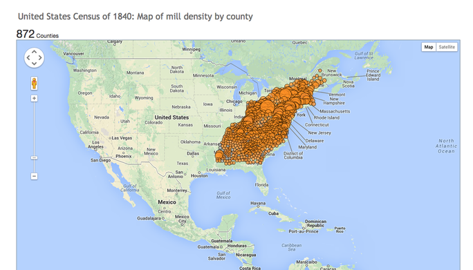
Just how many mill dams were there along the east coast US? Click on the image to visualize 
Picture

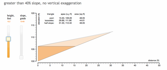
How much sediment backs up behind dams at different heights, in valleys with different slopes? Click on the image to see


Click on link below to download KML layer of BSR - for Google Earth:
BSR_slopeshade_GoogleEarth.kmz
File Size: 1002 kb
File Type: kmz
Download File


Powered by Create your own unique website with customizable templates.